

Quick answer
The primary snorkeling zones lie along Isla Mujeres' western and southern coasts: Garrafón Natural Reef Park at the southern tip (12–40 feet depth), Manchones Reef and its underwater sculpture garden one kilometer offshore from the west coast (15–30 feet), the shallows at El Farito lighthouse on Punta Sur (6–15 feet), and North Beach's calm entry point near Playa Norte (3–10 feet). Public beaches offer free shore access daily from 9:00 AM to 5:00 PM, while private reef parks and boat-accessed sites charge separate tour fees.
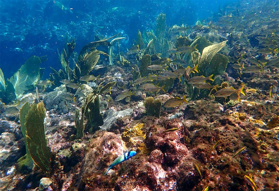
Isla Mujeres sits on a submerged limestone shelf that drops from knee-deep turtle grass flats to hundred-foot walls within a quarter mile of shore. The western coastline benefits from the island's wind shadow, creating predictable calm from November through April, while the exposed Caribbean side remains off-limits to snorkelers year-round due to surge and undertow. This asymmetry concentrates activity in four distinct zones, each defined by depth, marine life, and access method. North Beach marks the shallowest entry, where sandy channels between coral heads hold sergeant majors, parrotfish, and the occasional southern stingray. The reef line sits 200 meters offshore, accessible by swimming or renting a kayak from the beachfront operators. Water clarity peaks before 11:00 AM, when boat traffic from Cancún begins churning sediment. The Manchones section, reachable only by boat, hosts 500 cement sculptures installed between 2009 and 2013 as an artificial reef. Depth ranges from 15 to 30 feet over a sandy bottom, with brain coral colonies and schools of blue tangs now established on the statues. Most snorkeling tours allocate 45 minutes here before moving to natural reef. Garrafón occupies the southern cliffs, where the shelf breaks into vertical drop-offs. The park's contained snorkeling area holds elkhorn fragments, sea fans, and a resident population of yellowtail snappers conditioned to hand-feeding. Visibility regularly exceeds 80 feet, but the site demands confident swimming—rip currents form along the cliff base during outgoing tides. El Farito, a five-minute walk south from Garrafón's entrance, offers a middle option: waist-deep water over fire coral and sponge gardens, with frequent turtle sightings between May and September. No facility operates here; snorkelers wade in from the rocky beach and navigate by the lighthouse as a landmark. An isla mujeres snorkeling map should note distances in swim time, not linear meters. North Beach to the first coral heads: eight minutes at a moderate pace. Garrafón's entry ladder to the wall edge: twelve minutes against mild current. These figures assume calm seas—afternoon wind adds 30 percent to effort. The underwater sculpture park remains a boat-only destination; the swim from shore exceeds two kilometers across a shipping lane.
“Water clarity peaks before 11:00 AM, when boat traffic from Cancún begins churning sediment.”
The Best Time to Use an Isla Mujeres Snorkeling Map
The best arrival window for utilizing an Isla Mujeres snorkeling map is 09:00–11:00. Arriving during this period ensures optimal water clarity and lower wind speeds before afternoon boat traffic increases.
April to June
ModerateWarm, 28°C to 30°C
Whale shark season begins in late May and continues into September. Calm seas provide ideal conditions for navigating to snorkeling spots
July to August
HighHot, 30°C to 32°C
High temperatures attract more visitors to the reef areas. Mid-week morning sessions offer the most space for exploring sites
September to November
LowHumid, 26°C to 29°C
Lower visitor numbers make for quieter reefs. Morning conditions remain favorable for visibility despite potential autumn rain showers
Weekday mornings
Low—
Mid-week mornings provide the clearest water and the fewest crowds. Consistent morning arrival allows for better navigation using snorkeling maps.
Verdict: For the clearest water and fewest crowds, aim to visit on a weekday between April and June, arriving during the 09:00–11:00 window.
Key Locations on an Isla Mujeres Snorkeling Map
Understanding the primary reef systems and art installations helps orient your underwater exploration around Isla Mujeres. These locations are the focal points for most organized snorkeling excursions.
Manchones Reef
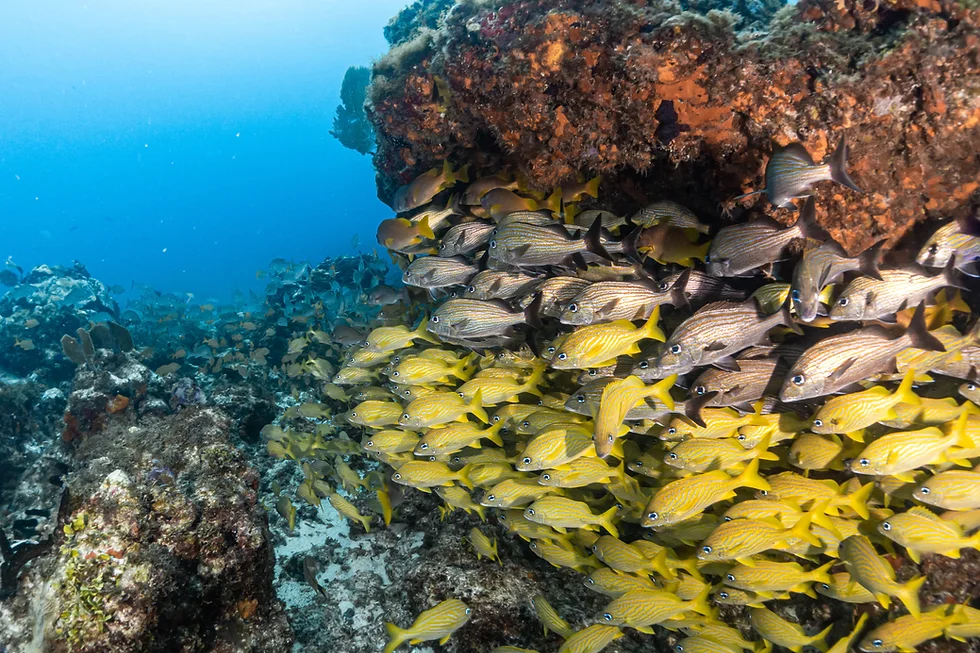
This extensive reef area features diverse coral formations and high fish density, making it a staple for local tours.
Focus on the deeper sections for better visibility and marine life.
MUSA Underwater Museum
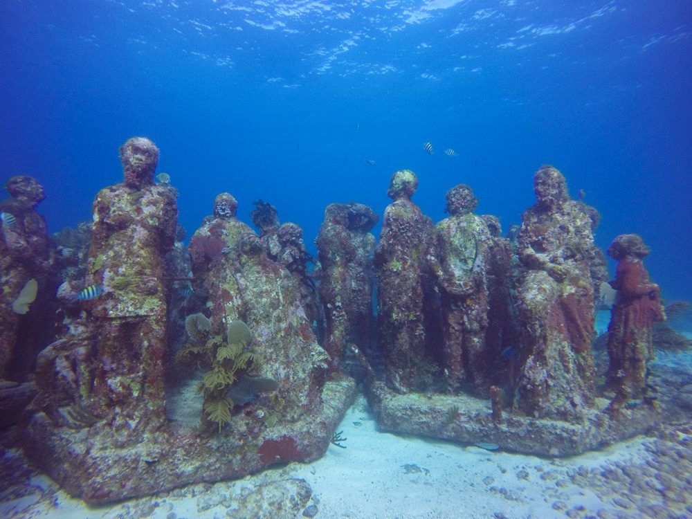
An underwater gallery featuring hundreds of life-sized cement sculptures designed to promote coral growth.
Visit during morning hours to avoid reflections and boat traffic.
El Farito
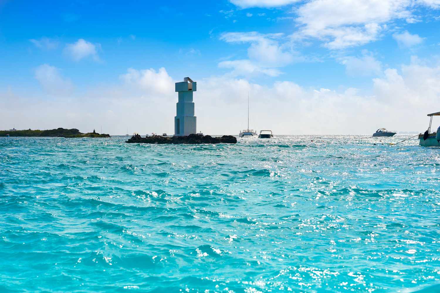
A shallow reef located near the lighthouse, ideal for beginners due to calm waters.
Look for sergeant major fish near the rocky reef structures.
Sac Bajo
Located on the western side, this area offers calm, sheltered waters perfect for casual observation.
Explore the grassy seagrass beds to find rays and crustaceans.
Getting to Snorkeling Sites on an Isla Mujeres Snorkeling Map
Isla Mujeres is located off the coast of Quintana Roo, Mexico, and most snorkeling sites are situated in offshore waters. Accessing these reefs requires transit via boat, typically arranged through professional tour operators or private charters.
Ultramar Ferry from Puerto Juarez to Isla Mujeres
Local tour operator vessel from Isla Mujeres piers
Walk from main ferry terminal to downtown docks
Operating Hours for Isla Mujeres Snorkeling Access
Public beaches and official snorkeling launch points in Isla Mujeres maintain consistent daily operating hours. These hours facilitate access to the surrounding reefs and marine parks throughout the week.
| Monday | 09:00–17:00 | |
|---|---|---|
| Tuesday | 09:00–17:00 | |
| Wednesday | 09:00–17:00 | |
| Thursday | 09:00–17:00 | |
| Friday | 09:00–17:00 | |
| Saturday | 09:00–17:00 | |
| Sunday | 09:00–17:00 |
Understanding Costs and Fees for Isla Mujeres Snorkeling
Snorkeling costs in Isla Mujeres depend on whether you access the water from public shores or utilize private boat tours to reach specific reef sites. Public beach access is free, while reef excursion fees vary based on the provider and inclusions.
While accessing the beach is 0 USD, visitors typically pay varying rates for private boat tours depending on the chosen snorkeling locations and tour duration.
Snorkeling Prep Checklist for Your Isla Mujeres Snorkeling Map
Snorkeling Isla Mujeres' reefs requires specific gear and preparation for open-water conditions.
-
Pack reef-safe sunscreen (biodegradable formula) — Chemical sunscreens damage coral; Mexican marine parks enforce reef-safe product rules.
-
Bring or rent a properly fitted mask — Ill-fitting masks flood constantly in choppy water, ruining visibility and comfort.
-
Wear a rash guard or wetsuit — Protects against sun, jellyfish, and scrapes on shallow coral during current shifts.
-
Carry waterproof pouches for valuables — Boats lack secure storage; phones and wallets need protection from salt spray.
-
Book snorkeling tours in advance — Morning departures fill quickly during peak season, and walk-up availability is limited.
-
Confirm departure times the day before — Weather delays and boat maintenance can shift schedules without advance notice.
Check availability
Frequently asked questions about isla mujeres snorkeling map
Everything you need to know about isla mujeres snorkeling map